NASA Imagery Details Twice-Daily Tidal Shifts in Guinea-Bissau Archipelago
Satellite imagery from NASA and the USGS highlights how daily tides reshape Guinea-Bissau's Bijagós Archipelago, temporarily expanding island landmasses during low tide.
Language:ENAR
AI-generated summary based on reports from nasa.govInstaBriefs does not carry out original reporting. Every fact below is traceable to the sources listed with this story.
30-second brief
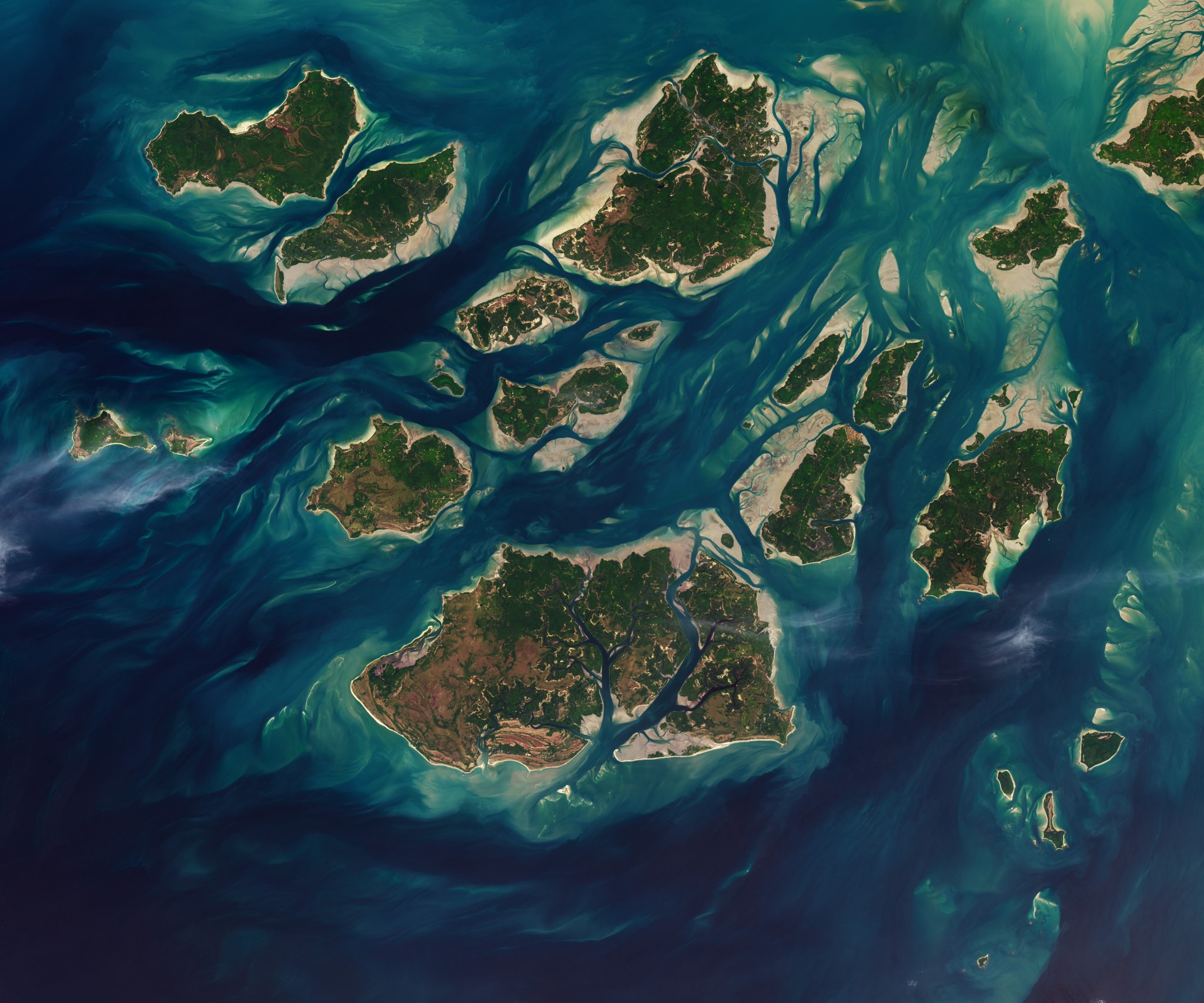
Satellite imagery from NASA and the USGS captured on November 28, 2025, reveals how twice-daily tides alter the landscape of Guinea-Bissau's Bijagós Archipelago. At low tide, emerging mudflats temporarily expand the visible size of the region's 88 islands.
One-minute read
A satellite photograph taken on November 28, 2025, by NASA and the USGS documents the dramatic impact of daily tides on Guinea-Bissau’s Bijagós Archipelago. Comprising 88 islands and islets, the archipelago features a complex environment of sandy channels, mudflats, and mangrove forests. Twice each day, ocean tides cycle through the area, exposing vast intertidal mudflats and sandflats during low tide. This process causes the islands to temporarily expand before high-tide waters submerge the land hours later. The image highlights the dynamic geography and ecological significance of the West African coastal region.
Why this matters
Monitoring intertidal dynamic changes offers valuable satellite data on coastal erosion, ecosystem stability, and landscape transformations in island environments.
Background
The Bijagós Archipelago is a cluster of 88 islands located off the coast of Guinea-Bissau. It features diverse ecosystems, including mangrove forests and intertidal mudflats.
Key terms
- Intertidal Zone
- The coastal area exposed to air at low tide and submerged under water at high tide.
- Bijagós Archipelago
- A group of 88 islands and islets located off the Atlantic coast of Guinea-Bissau.
Structured analysis built only from the verified reports behind this story.
AI analysis based on reports from nasa.gov. Not original reporting.
Key facts
- A satellite photograph taken on November 28, 2025, by NASA and the USGS documents the dramatic impact of daily tides on Guinea-Bissau’s Bijagós Archipelago.
- Comprising 88 islands and islets, the archipelago features a complex environment of sandy channels, mudflats, and mangrove forests.
- Twice each day, ocean tides cycle through the area, exposing vast intertidal mudflats and sandflats during low tide.
- This process causes the islands to temporarily expand before high-tide waters submerge the land hours later.
- The image highlights the dynamic geography and ecological significance of the West African coastal region.
Key numbers
- 28,
- A satellite photograph taken on November 28, 2025, by NASA and the USGS documents the dramatic impact of daily
- 88
- Comprising 88 islands and islets, the archipelago features a complex environment of sandy channels, mudflats,
A satellite image captured on November 28, 2025, showcases the dramatic environmental changes caused by natural tidal shifts in Guinea-Bissau’s Bijagós Archipelago. Released by NASA and the U.S. Geological Survey (USGS), the aerial photograph documents how twice-daily water movements alter the shape and size of the West African coastal landforms.
The Bijagós Archipelago consists of 88 islands and islets flanked by sandy channels, expansive mudflats, and dense mangrove forests. Twice every day, incoming and outgoing tides move through this intricate marine and coastal maze, transforming the visible terrain.
During low tide, extensive intertidal mudflats and sandflats emerge above the surface of the Atlantic Ocean. This temporary exposure causes the individual islands to grow significantly in visible land area. Within hours, as the tide rises again, the ocean waters submerge these flats, shrinking the landmass back to its high-tide contours.
The imagery captured by NASA's Lauren Dauphin and the USGS provides detailed insight into the dynamic geography of the archipelago. The region's fluctuating intertidal zones play a vital role in supporting local coastal ecosystems and wildlife.
Source attribution
Reported by 1 verified source· 1 verified outlet
Every brief lists the reporting it was written from.
- First published
- 3 Aug, 17:15
- Latest update
- 3 Aug, 17:15
- Confidence
- Medium
Based on how many independent verified outlets reported this story and whether their accounts agree.
- nasa.gov
Verified outletHQ Web Team
Story timeline
How this story developed, oldest report first.
NASA Imagery Details Twice-Daily Tidal Shifts in Guinea-Bissau Archipelago
nasa.gov
nasa.gov
Tags
Guinea-Bissau · Bijagós Archipelago · NASA · USGS · Environment · Tides
This brief was written by AI from reported sources and reviewed against our editorial policy.
Related briefs

NASA Delivers NavCube3-mini Navigation System for Commercial Lunar Relay
NASA delivered its compact NavCube3-mini navigation receiver to Intuitive Machines on July 13 for integration into the Altus-1 lunar relay satellite. The receiver uses Earth-based GPS and Galileo signals to track positions in lunar orbit, supporting future crewed and robotic missions to the Moon.

Ike Theriot Leads NASA Surface Testing for Artemis Lunar Missions
Ike Theriot, Flight Operations Surface Testing lead at NASA's Johnson Space Center, is helping prepare astronauts for upcoming Artemis missions by developing simulated moonwalks, evaluating spacesuits, and conducting field training.

NASA Highlights Artemis Missions and Space Science at FIFA World Cup
NASA engaged over 500,000 visitors with interactive exhibits, astronaut appearances, and educational displays at the FIFA Fan Festival in Houston during the World Cup tournament.

NASA Highlights Vaporizing Meteor Over the Lacerta Nebula
NASA's Astronomy Picture of the Day highlighted a streak of a vaporizing meteor caught on camera directly in front of the Great Lacerta Nebula.

NASA Highlights 'Fire Rainbow' Phenomenon Over West Virginia
NASA's Astronomy Picture of the Day featured a circumhorizontal arc, popularly known as a 'fire rainbow,' captured near North Fork Mountain in West Virginia. The visual phenomenon relies on specific solar angles and horizontally aligned ice crystals in high cirrus clouds.
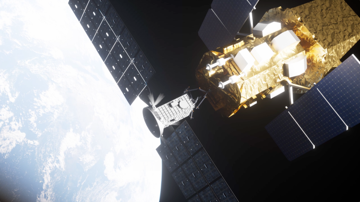
Engineers Work to Rescue Satellite Sent to Save NASA's Swift Mission
A refrigerator-sized rescue satellite named Link spun out of control during a mission to boost the orbit of NASA's $500 million Swift gamma-ray observatory. Engineers are currently attempting to fix thruster and hardware issues to regain control.
Discussion (0)
Discussion0 comments
Sign in to join the discussion.
No comments yet. Start the discussion.